National Trust – Climate change adaptation guidance
National Trust - Climate change adaptation guidance
For caretakers and managers of historic and beautiful places
Together with other heritage organisations, and thanks to INTO’s ‘Withstanding Change’ project, National Trust experts are developing a range of guidance for the owners and managers of historic and beautiful places.
This guidance is available to any heritage organisations looking after such places. The guidance aims to help sites become more resilient to climate change, and support teams to take decisions in the face of climate hazards.
NEW FOR NOVEMBER 2024: we’ve released chapters on caring for photographs in the context of climate change, managing visitor operations in wetter weather, and safeguarding roofless ruins and standing masonry. We’ve also created a new introductory chapter to support better understanding of climate change adaptation and approaches to planning adaptive pathways.

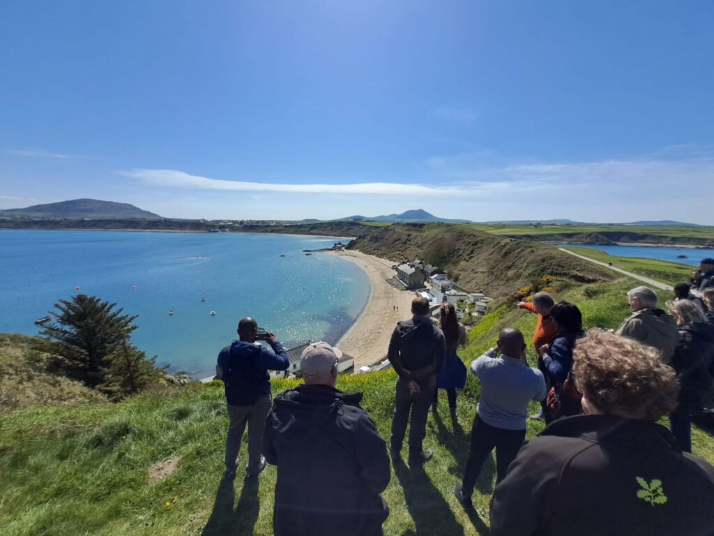
The seafront at Porthdinllaen – a National Trust site particularly exposed to sea level rise and other climate hazards
Each guidance chapter includes information about different asset types and activity associated with historic estates and landscapes, and provides hazard, impact and options tables for potential climate threats. The guidance also provides case studies and detail on options and thresholds for implementing adaptation measures, as well as useful advice on permissions and consents where statutory obligations apply.
There are more chapters still to come, so please watch this space for updates!
If you would like this guidance in an alternative format, please call 07977 634046 or email katherine.shingler@nationaltrust.org.uk.
Read the guidance
The National Trust owns over 400 historic places across England, Northern Ireland and Wales, with over 250,000 hectares of land. While later chapters of this guidance consider individual assets and activity, this opening section provides holistic guidance for our places, thinking about the inter-dependencies of the things in the care of the organisation and the way whole places will be threatened by climate hazards such as wildfires (see below).
WildfiresYou may also find it useful to look at our revised ‘Introduction to Climate Change Adaptation’, which provides an overview of holistic, place-based approached to adaptive pathway planning:
Introduction to Climate Change AdaptationThe National Trust is currently undertaking research on the impacts of climate change on visitor operations. We’ve published guidance on adapting to higher temperatures, and in November 2024 have released a new chapter on managing wetter weather:
Higher TemperaturesWetter Weather
The National Trust owns land with complex ecological systems that are continually impacted by surrounding pressures of development, land use and wider environmental issues such as water quality and soil condition. The National Trust is working hard to conserve the natural environment and was inspired to create this chapter by existing guidance on climate change adaptation for the natural and farmed environment, created by Natural England.
Natural England climate change adaptation guidanceWe’ve published three chapters on Gardens and Parks, taking in the measures that may be considered to safeguard and adapt cultivated plants, lawns and grass paths, and trees in designed landscapes to the impacts of climate change.
Cultivated PlantsLawns and Grass Paths Trees in the Designed Landscape
The National Trust holds over 250,000 hectares of land, much of which constitutes a farmed environment. Many of our farms are under agri-environment schemes and guidance produced by Natural England on the farmed environment is available via their web publications.
Natural England climate change adaptation guidanceThe National Trust owns around 800 miles of coastline around England, Northern Ireland and Wales. This land is vulnerable to shifting shores; erosion and accretion, impacting our historic and natural environment. The National trust is currently researching and developing guidance on this chapter following on from the launch of our Shifting Shores policy document which explains our approach to managing coast generally and adapting to climate change as part of this approach.
National Trust Shifting Shores ReportWater is potentially the most vulnerable asset and resource when it comes to climate hazards. From rivers to water features, the National Trust owns a range of sites that include water as a functional, natural or designed aspect. The sections below give detail on impacts, case studies, approaches and thresholds for change when considering climate change adaptation.
RiversWater Features
Water Sourcing & Efficiency
The National Trust has records of over 90,000 archaeological sites and features in its Historic Buildings, Sites and Monuments Record. Most of these sites are not protected by statutory designations and are vulnerable to land management practices, animal burrowing, vandalism and access erosion. These sites are also vulnerable to the changing climate and the compounding impacts of flooding, prolonged periods of rain, drought, landslides and coastal erosion. These factors affect features such as earthworks, buried remains and waterlogged deposits. The sections of this chapter below explore this in more detail.
Archaeological EarthworksBuried Archaeological Remains
Waterlogged Archaeological Remains
The National Trust is currently researching impacts of climate hazards on a range of internal fabric and collection types, working in collaboration with partner heritage organisations in the UK (below). The first of our chapters in this section covers paper and books, and we’ve recently added a further one on photographs, with more in development.
Paper and BooksPhotographs
The National Trust owns around 28,500 buildings across England, Northern Ireland and Wales. Most of these are of pre-1919 construction and are therefore principally of traditional materials such as brick and stone masonry, cob and timber framed. All buildings are vulnerable to climate change but can be kept resilient through effective management of water:
Rainwater goodsThe following chapter offers a wide-ranging look at adaptation of historic building fabric:
Historic Building FabricRoofless ruins and standing masonry are particularly vulnerable to climate change impacts:
Roofless Ruins and Standing MasonryThe National Trust owns and is responsible for over 30,000 kilometres of paths and tracks. These vary in construction type and are at varied levels of use, accessibility and vulnerability to climate hazards. We’ve published two chapters so far, on paths (a principal access route to National Trust places), and bridges, culverts and tunnels.
PathsBridges, Culverts and Tunnels
The National Trust is researching and developing guidance in this area of our assets and how to manage them in the face of climate hazards. Impacts of flooding and shrink-swell on sub-stations, sewage treatment systems and our mechanical and electrical infrastructure are already being experienced at many sites. Please check back for updates as we draw together case studies and research for publication in 2025.
In the knowledge of increasing exposure to climate hazards, but with the uncertainty of climate projections and future conditions, the National Trust is working with professionals in the operational risk, insurance and financial sectors to develop research and guidance around potential measures and thresholds that can be practically useful for owners and caretakers of historic places. Please check back as we develop this guidance.
As well as sustainable supply chains and commercial services, the National Trust is working to make sure that these business areas are also resilient to climate impacts. We’re conducting research to inform the publication of guidance in the near future – watch this space!
This guidance has been developed with Cadw, Department for Communities Northern Ireland, Historic Environment Scotland, Historic England, English Heritage Trust, and National Trust for Scotland.


National Trust hazard map
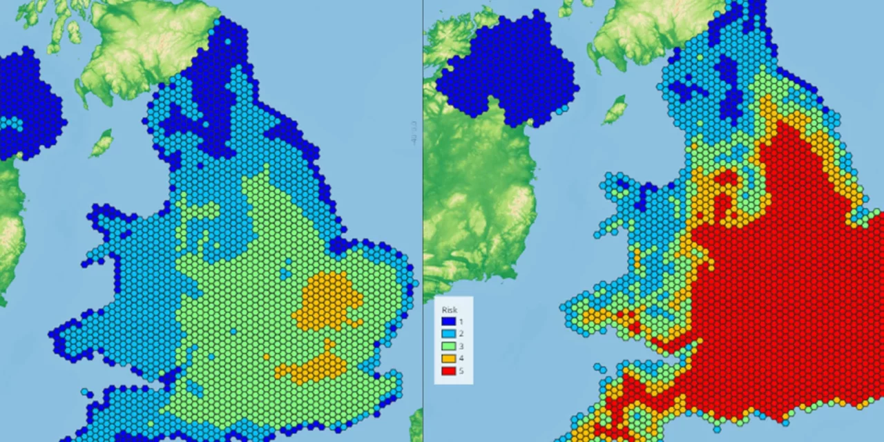
The National Trust has developed a hazard map that illustrates the threats posed by climate change. Working to a worst-case scenario model, the map plots places alongside existing data on climate change-related events, such as heat and landslides. It's the first map of its kind to collate and plot data in this way and will help the National Trust and other organisations identify the hazard level facing countryside locations, monuments, coastlines and historical sites in England, Wales, Northern Ireland and Scotland.
Explore the hazard map